
Subtle motion, deep time, and the ongoing adjustment of the Great Lakes basin
The rebound isn’t a metaphor, not really. It is a slow release, a geological exhale that never finishes. I grew up near the Great Lakes, and next to one that was briefly declared a “Great Lake” by the US government for eighteen days before the guardians of the “Great Lakes” caught up, so the classification itself always felt a little provisional. That mattered. It gave me an affinity for their story, the great sweep of geology that reaches backward to before Pangea, but this essay is not about that deep time. It is focused on something closer, more recent, the kind of geology that still shows up in modern maps and in the entire focus of one geology course from college, where the continent was treated less as a static object and more as a system still adjusting. The water looked permanent, but the ground did not feel fixed. Even then, I was already living inside a delayed motion, a plate still unbending from an ancient load.
In college, that reality sharpened into a full course on post-glacial rebound, the kind where the professor drew cross sections across the continent and let the lines do the talking. The North American plate, pressed down by ice sheets that reached as far south as the Ohio River during the Last Glacial Maximum, had been compressed like a slow, stubborn spring. Ice thickness in the central lobes exceeded a mile in places, and the rule of thumb we were given stuck with me: roughly one inch of vertical depression for every three inches of ice (Peltier, Postglacial Variations in the Level of the Sea, 2004). You could run that ratio forward and backward and still feel uneasy about it. The weight of a continent quantified in inches.
I remember standing on a shoreline in Minnesota years later, where the land felt oddly unsettled, not because of the water but because of the small, quiet absence of water. Pothole lakes, those scattered depressions carved and re-carved by ice, were vanishing in real time. Not all at once. A few wet years, a few dry ones, then a basin that would not refill. Studies of the prairie pothole region document this trend, tying it to both climatic variability and longer-term hydrologic change, but the part I keep coming back to is not the cause, it is the pattern: the landscape is not holding still enough to preserve its own punctuation (Johnson et al., Prairie Pothole Hydrology, 2010).
The Great Lakes themselves carry a more visible version of that imbalance. Satellite and gauge studies have shown a subtle tilt, a differential rise where the southern shores gain a little more water height while the northern shores lose, on average, about an inch per decade when adjusted for regional variation (Gronewold & Rood, Great Lakes Water Level Variability, 2018). The numbers are small enough to ignore, until you imagine them stacked. Ten decades. Twenty. A foot of change here, a foot of loss there. What does a lake look like when its basin is slowly skewing beneath it?
I think about that tilt as if someone has placed a long plank across the lakes, seesawing from north to south. The north, still rebounding out of its glacial depression, rises at a different rate than the south. It is not uniform, not polite, not balanced. The crust is still responding to a load that was removed thousands of years ago, and the response is uneven, still working through the geometry of release. The Canadian Shield, once deeply pressed, is rising faster in places, while peripheral areas lag behind, and the lakes themselves sit in the middle of that differential motion (Peltier, Glacial Isostatic Adjustment Models, 2015).
I often return to the silence of that idea. The ice is gone, but the system is still negotiating. You can see it in shorelines that feel newly drawn, in wetlands that are either expanding or collapsing depending on which side of the tilt you stand on. It’s tempting to ask whether the lakes are shrinking or shifting, but that question misses the more unsettling point. They are doing both, but not evenly, not symmetrically.
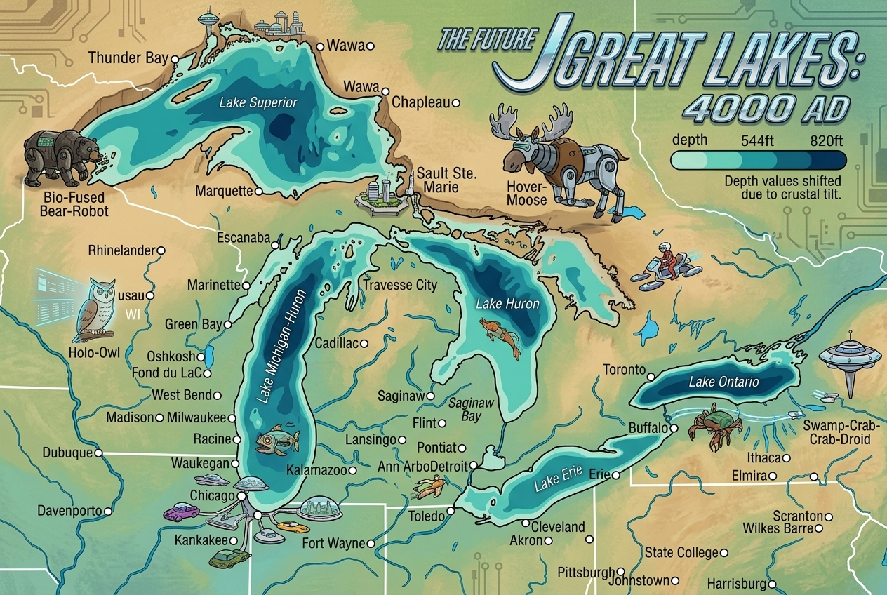
What happens in 200 years? I’ve tried to visualize it the way I was taught to visualize cross sections. Imagine a line drawn across Superior, Huron, Erie, Ontario. Now tilt that line slightly, barely perceptible, but persistent. Extend it forward two centuries. The southern margins, particularly in Lake Erie and Lake Ontario, would sit higher relative to their northern counterparts. The northern shorelines of Superior and Huron, still adjusting, may drain slightly more efficiently as uplift continues. The basins themselves will have shifted shape. The water will not vanish, but its distribution will not resemble what we know now. Even small rates compound into a different geometry over that time span, especially where the land itself is in motion.
The glaciers that once covered this region were not gentle blankets. They were dynamic masses, advancing and retreating, reshaping the underlying crust and carving out the basins that would become the Great Lakes. The idea that they extended as far south as the Ohio River still feels almost unreal, but the sediment records and striations confirm it (Clark et al., Last Glacial Maximum Extent, 2009). That southern reach is not just a historical note. It frames the scale of what was removed. The rebound is still catching up to that absence.
In my own lifetime, I expect less dramatic but still legible changes. At 20 years, the differences will look like anomalies in data sets, a few inches here, a few there, shoreline adjustments that are noticeable only if you are already looking for them. Some land in Canada will flood more easily, your garden in Waukegan needs to be watered more. At 50 years, the tilt becomes more difficult to dismiss. Coastal infrastructure, particularly in low-lying southern areas, will have had to adjust to persistent high-water regimes, while northern regions may see increased exposure of previously submerged land. Sandbars and shoals would become more of sailing hazard in Saginaw Bay. At 100 years, the map begins to drift from memory. The lakes will still be recognizable, but their edges will no longer align with older surveys. Saginaw and Georgian Bays are noticeable smaller because small vertical shifts translate into measurable horizontal movement. And at 200 years, the system will be a different one altogether, still called the Great Lakes, but no longer matching the internal geometry I grew up with.
I keep returning to a simple question: if the ground is still moving, what does stability even mean here? We tend to think of lakes as fixed elements in a fixed landscape, but the data persistently contradicts that. The land continues to rise, the water continues to reorganize, and the entire system carries the imprint of an ice sheet that is no longer present but still active in its aftereffects.
The key to understanding the longer arc is that this is not a system aiming at a fixed endpoint so much as one pursuing equilibrium under shifting constraints. Glacial isostatic adjustment is still ongoing because the mantle response time is on the order of thousands of years, not decades, so the “rebound” is slow, delayed, and uneven across the basin. That means the northern shore continues to rise faster than the southern shore, gradually tilting the lake region as a whole (Peltier, Postglacial variations in the level of the sea, 2004; Larson and Schaetzl, Rates of glacial isostatic adjustment, 2001). I find it striking that even the idea of “level” becomes relative here, because what looks flat on human timescales is actually a long, shallow gradient unfolding across geological time.
The rebound does not have a clean stopping point in the present sense. It effectively stops only when the ice‑loaded mantle has finished relaxing toward isostatic equilibrium, which is already close in Hudson Bay but still incomplete in the Great Lakes region, and it would be interrupted or reset if a new ice sheet formed (Peltier, 2004; Andrews, Postglacial rebound, 1993). In a fully completed rebound scenario, estimates suggest total uplift since deglaciation on the order of hundreds of meters in the north (often 100–300 m range depending on location) and tens of meters in the south, reflecting the former ice‑sheet thickness and load distribution (Peltier, 2004; Wu, Glacial isostatic adjustment, 2010).
For the lake region itself, that differential matters more than the absolute values. The north shore rising faster than the south means a long‑term tilting of roughly millimeters per year (an average of ~1/10” per year), which accumulates into significant relative elevation change over millennia. The effect is not that the entire basin “lifts uniformly,” but that its geometry slowly warps, subtly reorganizing drainage, shoreline position, and local base levels. I personally read that as the real takeaway: stability here is a moving target defined by the balance between ongoing rebound and the competing processes of erosion and sedimentation, not a static end state.
I’ve stood on those shores and tried to see both the immediate water and the ancient compression beneath it. I’ve tried to square the calm surface with the uneven rebound underneath. The two don’t quite fit together, and that mismatch is the point. The Great Lakes are not just water bodies. They are an ongoing adjustment, a long-term response still unfolding. You can watch it if you know where to look, or you can ask yourself why the horizon does not feel as level as it should.
References
• Clark, P. U., et al. Last Glacial Maximum Extent. 2009.
• Gronewold, A. D., & Rood, R. B. Great Lakes Water Level Variability. 2018.
• Johnson, L., et al. Prairie Pothole Hydrology. 2010.
• Peltier, W. R. Postglacial Variations in the Level of the Sea. 2004.
• Peltier, W. R. Glacial Isostatic Adjustment Models. 2015.
• Andrews, J. T. Postglacial Rebound. 1993.
• Larson, G., & Schaetzl, R. Rates of Glacial Isostatic Adjustment in the Great Lakes Region. 2001.
• Wu, P. Glacial Isostatic Adjustment. 2010.

Leave a Reply